Conny Waters – MessageToEagle.com – Archaeologists have once again used LIDAR technology with success. Using light detection and ranging technology scientists have located the world’s oldest and largest Maya structure in Tabasco, Mexico, near the northwestern border of Guatemala.
The newly discovered site of Aguada Fénix lurked beneath the surface, hidden by its size and low profile, until 2017. The monument measures nearly 4,600 feet long, ranges from 30 to 50 feet high and includes nine wide causeways.

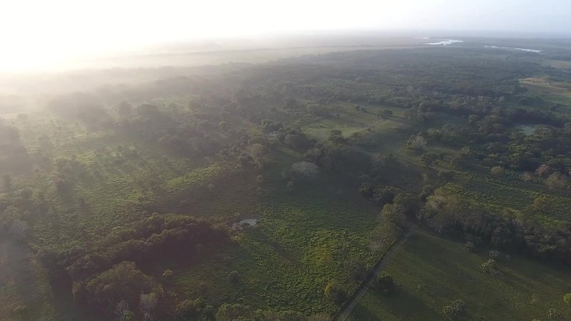
Aerial view of Aguada Fenix Main Plateau and the ramps connecting to causeways viewed from northwest. Credit: Takeshi Inomata
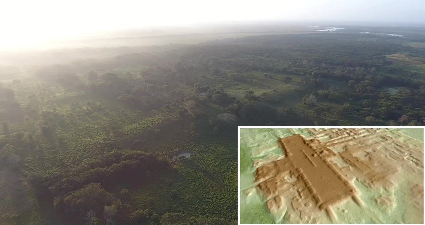
The science team led by Takeshi Inomata and Daniela Triadan, professors in the University of Arizona School of Anthropology in the College of Social and Behavioral Sciences used LIDAR which uses laser-emitting equipment from an airplane. Laser beams penetrate the tree canopy, and their reflections off the ground’s surface reveal the three-dimensional forms of archaeological features.
The team then excavated the site and radiocarbon-dated 69 samples of charcoal to determine that it was constructed sometime between 1,000 to 800 B.C. Until now, the Maya site of Ceibal, built in 950 B.C., was the oldest confirmed ceremonial center. This oldest monumental building at Aguada Fénix is also the largest known in the entire Maya history, far exceeding pyramids and palaces of later periods.
“Using low-resolution lidar collected by the Mexican government, we noticed this huge platform. Then we did high-resolution lidar and confirmed the presence of a big building,” Inomata said. “This area is developed – it’s not the jungle; people live there – but this site was not known because it is so flat and huge. It just looks like a natural landscape. But with lidar, it pops up as a very well-planned shape.”
The discovery marks a time of major change in Mesoamerica and has several implications, Inomata said.
First, archaeologists traditionally thought Maya civilization developed gradually. Until now, it was thought that small Maya villages began to appear between 1,000 and 350 B.C. – what’s known as the Middle Preclassic period – along with the use of pottery and some maize cultivation.
Second, the site looks similar to the older Olmec civilization center of San Lorenzo to the west in the Mexican state of Veracruz, but the lack of stone sculptures related to rulers and elites, such as colossal heads and thrones, suggests less social inequality than San Lorenzo and highlights the importance of communal work in the earliest days of the Maya.
“There has always been debate over whether Olmec civilization led to the development of the Maya civilization or if the Maya developed independently,” Inomata said. “So, our study focuses on a key area between the two.”
See also:
The 100-Kilometer-Long Stone Highway That Connected Ancient Maya Cities Revealed By LIDAR
More Than 60,000 Ancient Maya Structures Obscured By Inaccessible Forest Revealed By LIDAR
LIDAR Technology Reveals Secrets Of Ancient Maya Civilization
The period in which Aguada Fénix was constructed marked a gap in power – after the decline of San Lorenzo and before the rise of another Olmec center, La Venta. During this time, there was an exchange of new ideas, such as construction and architectural styles, among various regions of southern Mesoamerica. The extensive plateau and the large causeways suggest the monument was built for use by many people, Inomata said.
“During later periods, there were powerful rulers and administrative systems in which the people were ordered to do the work. But this site is much earlier, and we don’t see the evidence of the presence of powerful elites. We think that it’s more the result of communal work,” he said.
The fact that monumental buildings existed earlier than thought and when Maya society had less social inequality makes archaeologists rethink the construction process.
3D image of the recently recognized Maya site of Aguada Fenix, based on lidar. Credit: Takeshi Inomata
“It’s not just hierarchical social organization with the elite that makes monuments like this possible,” Inomata said. “This kind of understanding gives us important implications about human capability, and the potential of human groups. You may not necessarily need a well-organized government to carry out these kinds of huge projects. People can work together to achieve amazing results.”
Inomata and his team will continue to work at Aguada Fénix and do a broader lidar analysis of the area. They want to gather information about surrounding sites to understand how they interacted with the Olmec and the Maya.
They also want to focus on the residential areas around Aguada Fénix.
“We have substantial information about ceremonial construction,” Inomata said, “but we want to see how people lived during this period and what kind of changes in lifestyle were happening around this time.”
Written by Conny Waters – MessageToEagle.com – AncientPages.com Staff Writer


