MessageToEagle.com – Using highly sophisticated technology archaeologists have once again made an astonishing and significant discovery. Satellite images reveal world’s oldest network of superhighways hidden in the rain forest in Guatemala.
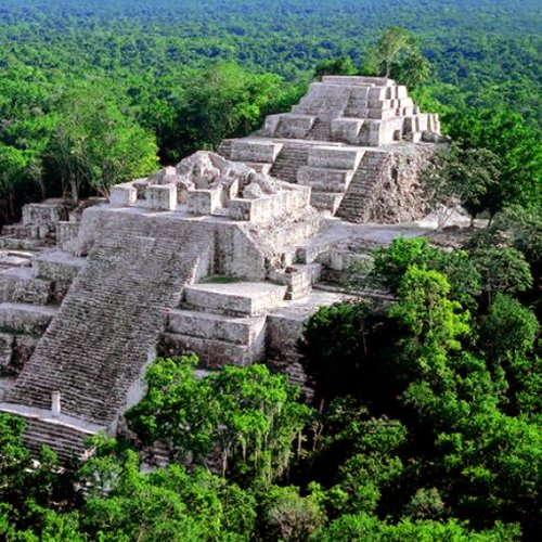
Today, overgrown by jungle, El Mirador is a large pre-Columbian Mayan settlement, located in the north of the modern department of El Petén, Guatemala.

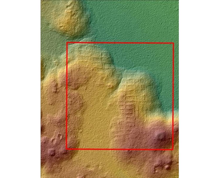
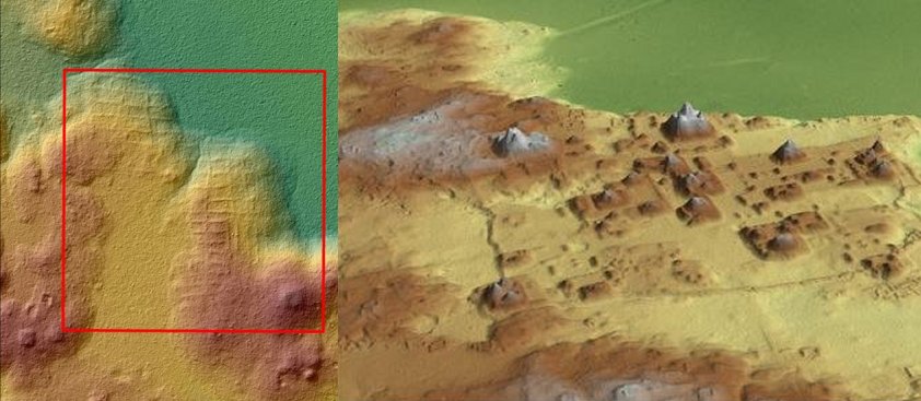
This ancient site was once the thriving capital of the Maya civilization. The place is very difficult to access and that is why airborne laser scanning (LiDAR) technology can help scientists to unravel some of the many mysteries hidden in this ancient lost city that was once inhabited by 1 million people before its collapse in 150 B.C.
As many as 17 ancient roads stretching over over 240 km (150 miles) were discovered by researchers from the Cuenca Mirador Archaeological Project, led by archeologist and anthropologist Richard D. Hansen of the University of Utah.

This huge ancient network of superhighways is estimated to be 2,000-year-old, making it the world’s oldest roads used for transportation. The researchers discovered pyramids, terraces, canals, dikes, walls and streets.
According to Hansen, El Mirador was once the largest city in the western hemisphere. “It was the first state in America,” said Hansen.
Tikal, the largest excavated site in the Americas contains some of the most fascinating archaeological remains of the ancient Mayan civilization, but El Mirador, argues Hansen, was larger than Tikal, and this lost city is still greatly unexplored.
When scientists use LIDAR, the Earth’s surface is scanned with laser beams and a three-dimensional map of the region is created.
This amazing place has been hidden in the sub-tropical forests for centuries. Only jaguars and monkeys were aware of the existence of the stony mountains between the trees.
See also:
El Mirador: Ancient Pyramids Hidden In The Lost City Of The Maya
Satellite Images Reveal 10,500-Year-Old Lost City Hidden Beneath The Forest Of Oklahoma
Did Water Shortage Cause The Demise Of The Ancient Maya Civilization?
Called “El Mirador” today (spanish for “the look-out”, but anciently known as the Kan Kingdom), the site was first discovered in 1926.
It was photographed from the air in 1930, but the remote site deep in the jungle had little more attention paid to it until Ian Graham spent some time there making the first map of the area in 1962.
Scientists will resume the research work of El Mirador next year. This ancient place is threatened by large-scale clearing and destruction of the surrounding environment by a ranching industry financed in part by drug trafficking, slash-and-burn clearing for agricultural purposes, logging, and extensive looting of El Mirador and surrounding archaeological sites have all combined to place El Mirador on the list of sites endangered for extinction.
Saving El Mirador is now a race against time and that is also why researchers will ask governments to develop a tourism route that respects the environment
This year has been successful for archaeologists who have used LIDAR technology to discover new ancient places. As previously reported by MessageToEagle.com just a few days ago satellite images have revealed a 10,500-year-old lost city hidden beneath the forest of Oklahoma.
NASA’s LIDAR technology has also been used to pinpoint the site of the legendary lost “Ciudad Blanca” in Honduras and a mysterious ancient spiral structure and buried towers at Angkor Wat.
We can expect many more exciting ancient discoveries in the future when more archaeologists use LIDAR.
MessageToEagle.com


