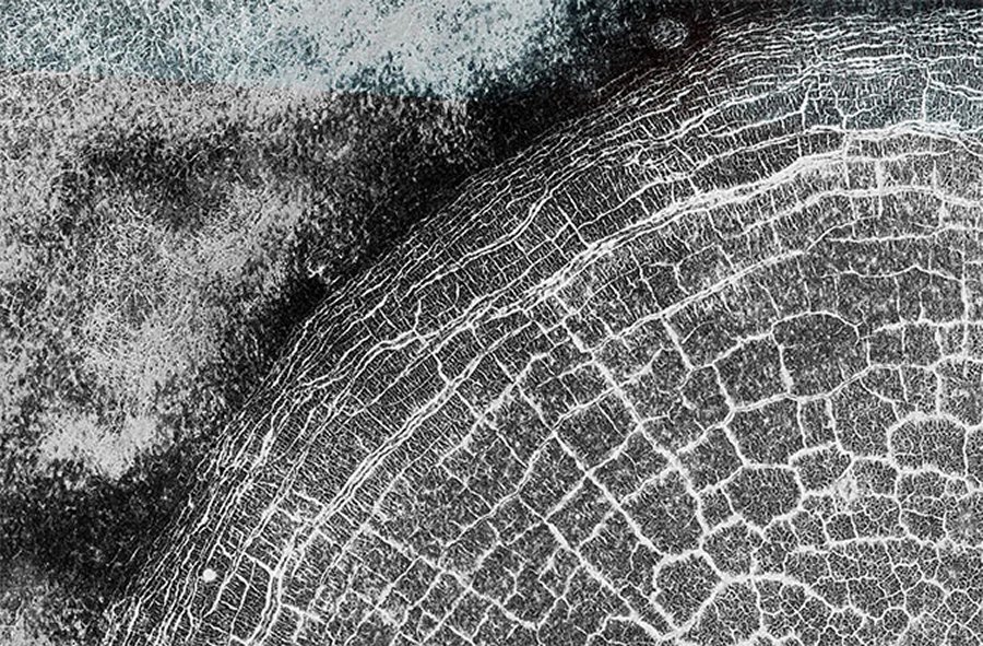
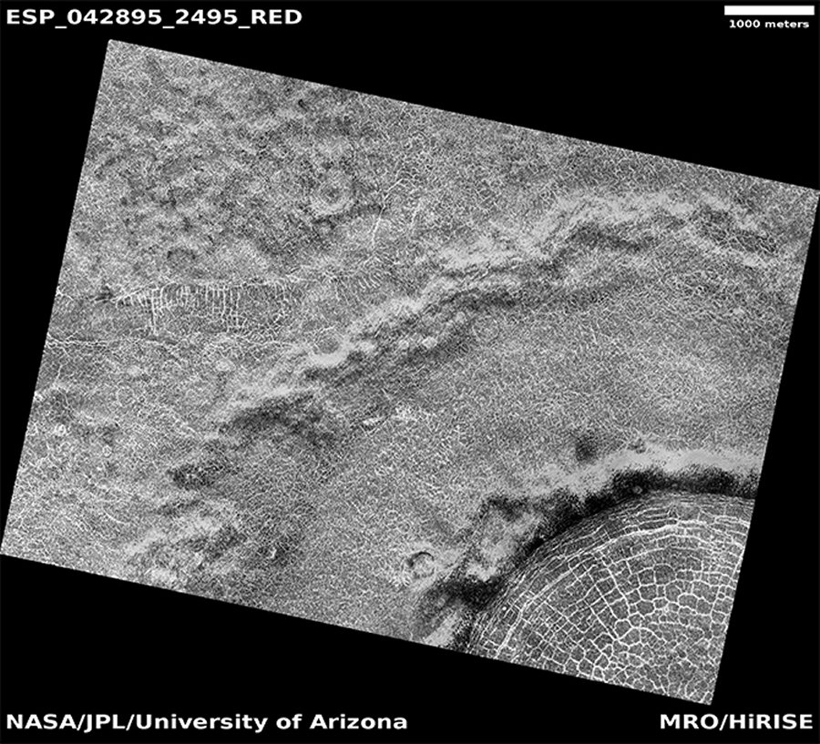
MessageToEagle.com – A lacy web of bright frost-filled fractures fills a crater near the north pole of Mars in this image, acquired Sept. 20, 2015 with the HiRISE camera aboard NASA’s Mars Reconnaissance Orbiter (MRO).

PHOTOS: Weirdest Mars Craters Spotted by HiRISE
The entire crater is around 3 miles (5 km) across and its ancient interior has undergone countless millennia of freeze/thaw cycles that have broken the surface into polygonal shapes. This process is common on Mars and can even be found on Earth, but this particular image depicts it exceptionally nicely.
The fractured surface polygons can be seen to get more compressed nearer to the crater’s rim. The image description by the HiRISE team explains:
The crater rim constrains the polygon formation within the crater close to the rim, creating a spoke and ring pattern of cracks. This leads to more rectangular polygons than those near the center of the crater. The polygons close to the center of the crater display a more typical pattern. A closer look shows some of these central polygons, which have smaller polygons within them, and smaller polygons within those smaller polygons, which makes for a natural fractal!
PHOTOS: NASA Spacecraft’s Epic 10 Years of Mars
A full map-projected scan of the area is below:

Credit: NASA/JPL-Caltech/University of Arizona
Launched Aug. 12, 2005, the MRO spacecraft has been studying the surface of Mars from orbit since March 2006. Its High-Resolution Imaging Science Experiment (HiRISE) camera, run by researchers at the University of Arizona’s Lunar and Planetary Laboratory, provides incredibly detailed images of Mars’ varied terrain in visible and near-infrared wavelengths.
PHOTOS: Mind-Blowing Beauty of Mars’ Dunes
HiRISE is capable of resolving structures on Mars’ surface down to about a meter in size from its location in orbit. The image above was acquired from a distance of 196 miles (314 km). You can see many more images from HiRISE here.
Source: HiRISE/University of Arizona
This article was provided by Discovery News.
MessageToEagle.com via Space.com


