Written by Eddie Gonzales Jr. – MessageToEagle.com Staff Writer
Frostquakes: A New Earthquake Risk In The North?
Eddie Gonzales Jr. – MessageToEagle.com – A new study has identified a potentially growing natural hazard in the north: frostquakes. With climate change contributing to many observed changes in weather extremes, such as heavy precipitation and cold waves, these seismic events could become more common.
Researchers were surprised by the role of wetlands and drainage channels in irrigated wetlands in origin of frostquakes.
Frostquakes are seismic events caused by the rapid freezing of water in the ground. They are most common during extreme winter conditions, when wet, snow-free ground freezes rapidly. They have been reported in northern Finland in 2016, 2019 and 2022, as well as in Chicago in 2019 and Ottawa in 2022, among others.
Roads and other areas cleared of snow in winter are particularly vulnerable to frostquakes. “It was previously thought that roads were the main areas, from which frostquakes originate. Unpredicted in our new study was the importance of wetlands and drainage channels. We found that during the winter of 2022–2023 the main sources of frostquakes in Oulu, Finland were actually swamps, wetlands and areas with high water tables or other places where water accumulates,” says Elena Kozlovskaya, Professor of applied geophysics at the University of Oulu Mining School.
When water in the ground, accumulated during heavy rainfalls in autumn or melting of snow during warm winter weather, freezes and expands rapidly, it causes cracks in the ground, accompanied by tremors and booms. When occurred in populated areas, frostquakes, or cryoseisms, are felt by people and they can be accompanied by specific noises. Ground motions during frostquakes are comparable to those of other seismic events, such as more distant earthquakes, mining explosions and vibrations produced by freight trains. Frostquakes are also known phenomenon in permafrost regions.
The new study, currently available as a preprint and set to be published in the journal EGUsphere, is the first applied study of seismic events from marsh and wetland areas. Researchers from the University of Oulu, Finland and the Geological Survey of Finland (GTK) showed that fracturing in the uppermost frozen ground can be initiated if the thickness of frozen layer is about 5 cm and larger. Ruptures can propagate deeper and damage infrastructure such as buildings, basements, pipelines and roads.
“With climate change, rapid changes in weather patterns have brought frostquakes to the attention of the wider audience, and they may become more common. Although their intensity is usually low, a series of relatively strong frostquakes in Oulu, 2016, which ruptured roads, was the starting point for our research. Frostquakes affect northern regions internationally, but they have been little studied using seismic instrumentation,” says Kari Moisio, a senior researcher at the University of Oulu. Usually, in winter, snowpack protects the ground from the cold. As the snow melts away with the changing weather conditions, the ground is exposed to frost.
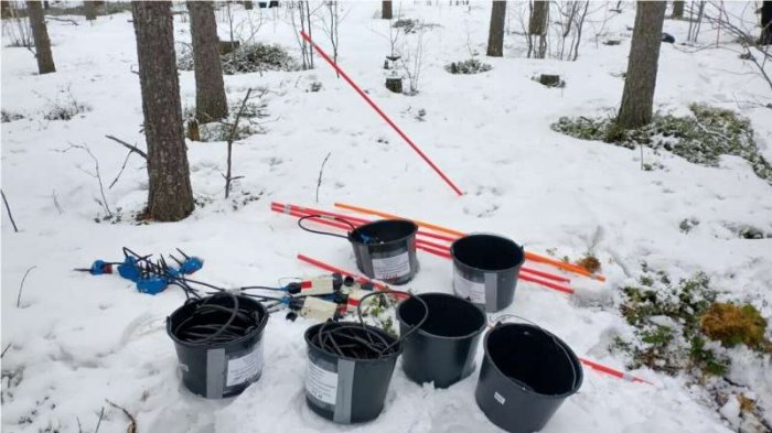
For the winter of 2022–2023, the researchers installed two seismic station networks in northern Finland, one in Oulu and the other in Sodankylä, with specific purpose to record frostquakes. The networks recorded seismic signals as well as soil temperature data. During several days when the air temperature was decreasing rapidly, the local residents reported ground tremors and unusual sounds to the researchers. These observations were used to identify frostquakes from seismic data. The conditions for a frostquake are favorable when the temperature drops to more than—20°C at a rate of about one degree per hour.
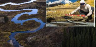
There are many wetlands close to seismic stations in Oulu near residential area where the main sources of frostquakes were detected. In Sodankylä, the frostquakes were in addition caused by ice fracturing in the Kitinen river. “Frostquakes have often occurred in January, but other times are also possible,” says Moisio.
During frost quakes, seismic surface waves produce high ground accelerations at distances of up to hundreds of meters. “The fractures during frostquakes seem to propagate along drainage channels near roads and in irrigated wetlands” Kozlovskaya says.
Irrigated wetlands and drainage channels are also abundant around residential areas. According to the researchers, the role of the ditches should be modeled using a technique currently under development at GTK. “Frostquakes have been recorded at two locations in Finland, and it would be important to map more precisely how common they are in other areas as well, and this is something that we are going to do in the future,” Kozlovskaya concludes.
Further studies will help to identify areas at risk of frostquakes, which will help to prepare and protect the built environment from this specific natural hazard. Researchers at the University of Oulu and GTK aim to create a system that could predict frostquakes based on soil analysis and satellite data.

